


Volcanoes & Earthquakes
4.4686.00 Reviews
App Specs
- Version
- 2.23.3
- Updated On
- License
- Free
- Downloads
- 1,000,000+
- Developer
- VolcanoDiscovery
- Categories
- Weather
- Platform
- Android
Screenshots
 Analysis by AppCompare
I like that this app is focused on a subject most everyday weather tools barely touch: what is happening beneath the surface of the planet. Volcanoes & Earthquakes is a weather-category app from VolcanoDiscovery, but its appeal is really for people who want to follow seismic events and volcano activity rather than check whether they need an umbrella. I would treat it as a way to explore and keep up with activity, not as a substitute for official emergency instructions.
What the free access means in practice
The app is free to download, which makes it easy to try without committing money up front. There are in-app purchases, with listed items ranging from $0.49 to $46.99, so “free” does not mean every paid option is included at no cost. I would start with the free experience and only consider paying if I had used it long enough to know that a particular extra mattered to me. The range is wide, so it is worth checking the price and what an item provides before confirming any purchase.
That distinction matters because the core appeal is the ability to look at earthquake and volcano activity, maps, news, and statistics in one place. If those are the things you want to explore, the free starting point may already make the app worthwhile. If you mainly want routine local forecasts, paying for extras here is unlikely to be the best route; a conventional weather app is designed around that everyday need.
Getting Started with the App
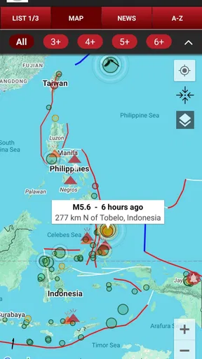
Downloading and setting up Volcanoes & Earthquakes was a breeze. Available for both Android and iOS, the app provides a seamless experience right from the get-go. The interface is clean and intuitive, which is a big plus for someone like me who isn’t exactly tech-savvy. As soon as you open it, you’re greeted with a world map dotted with recent seismic activities. It’s like stepping into a live global monitoring station!
Making the map useful, not overwhelming
A global map can quickly become a wall of dots if I open it without a question in mind. I get more out of it by choosing a region first, then checking individual events rather than trying to interpret every mark on the planet at once. That simple habit turns browsing into a useful routine: I can look at a place I care about, open an event for context, and then zoom back out to understand where it sits in the wider pattern.
This is also where the app’s educational value feels strongest. The map encourages me to connect location with event details instead of treating an earthquake as a number in a headline. For a student or a curious traveler, comparing activity across regions can prompt better questions about geography and geology. I would still avoid drawing conclusions from a quick visual scan; a map helps orient me, but it is not a lesson in hazard forecasting.
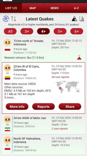
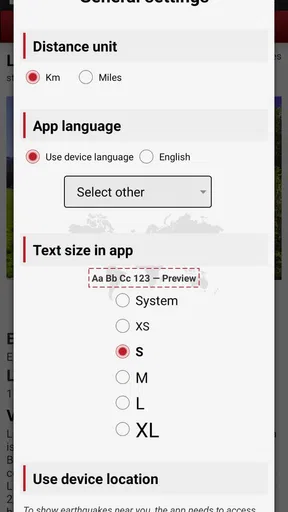
One of the coolest features is the ability to customize notifications. You can choose to receive alerts for quakes and volcanic eruptions based on location and magnitude. So, if you’re planning a trip or just want to stay informed about a specific area, you’re covered. I set mine to alert me for any activity over a magnitude of 4.0, and it’s been quite enlightening.
Worth Reading Before You Choose

EA SPORTS FC Mobile 26 Is a Bigger Football Game, but It Takes Time

Flipboard Shows What News Apps Must Do Beyond the Feed

Switching to Android Auto Means Rethinking Your Driving Routine

Google Calendar Makes a Crowded Week Easier to Manage

Ludo King Makes the Most of the Minutes Between Plans

Baby Panda World Brings Quick Play to Modern Phones, but Its Game Library Feels Busy
Features That Rock
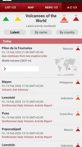
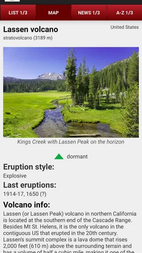
Let’s dive into the nitty-gritty. The app offers a plethora of features that cater to both novices and experts. You can view detailed information about each event, including depth, magnitude, and even the number of aftershocks. For the volcano enthusiasts, there’s a dedicated section that provides updates on volcanic activity, complete with historical data and imagery.
Those details are most helpful when I use them as a starting point, not as a verdict about what an event means for a particular building, road, or community. Magnitude and depth give useful context, while the aftershock information helps explain why one event can remain relevant after the first report. For a more careful check, I would compare what I see with guidance from local authorities, especially if I am nearby or making a safety decision.
A practical workflow is to save a few places in my own mental routine rather than constantly scanning everywhere: home, a destination I am considering, and a region I follow for personal interest. When an alert arrives, I can open the relevant area and inspect the event details instead of reacting to a notification in isolation. This is a more measured way to use a live tracker, and it helps keep curiosity from turning into unnecessary alarm.
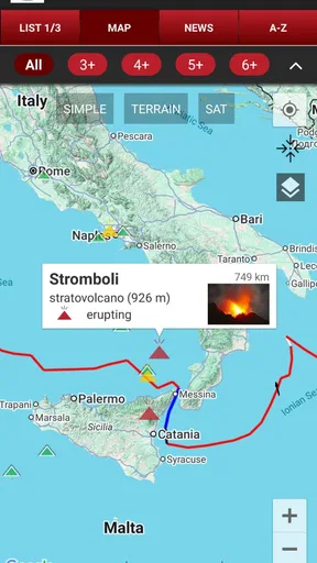
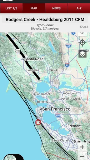
Another standout feature is the interactive map. You can zoom in on specific regions and see the seismic activity in real-time. I spent hours exploring different parts of the world, learning about tectonic plates and fault lines. It’s educational and surprisingly addictive!
User Experience and Design
The design of the app is straightforward yet engaging. The color-coded map makes it easy to differentiate between various types of events. I appreciate the use of icons and symbols, which add a layer of clarity without overwhelming the user. The app runs smoothly without any noticeable lags, which is essential when you’re dealing with real-time data.
For everyday use, I would keep notifications focused on places I genuinely care about. Broad alert settings can make a global subject noisy, while a location-based approach makes each ping easier to interpret. If I am traveling, I would review the area before departure and use the map as a reference during the trip; I would not rely on it to decide whether a route or building is safe. The app helps me stay informed, while local emergency guidance remains the right source for action.
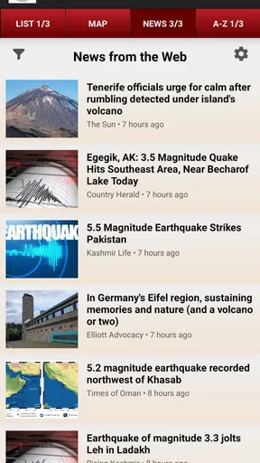
There’s also a community aspect to the app. Users can share reports and insights, which adds a social element to the experience. It’s fascinating to read firsthand accounts from people who have felt tremors or witnessed eruptions. It’s like being part of a global network of earthquake and volcano enthusiasts.
Those accounts add a human perspective that a list of event figures cannot provide, but I treat them as personal reports rather than verified instructions. A short account can help me understand how an event was experienced in one place; it cannot tell me what conditions are like everywhere nearby. That difference is important when the subject is a natural hazard, and it is one reason I would pair the app’s community material with trusted local updates.
Where it fits beside ordinary weather apps
Compared with a typical weather app, this one serves a narrower and more specialized purpose. A standard forecast app is the better choice when I need temperature, rain, wind, or a quick answer about what to wear. This app makes more sense when I want to follow seismic activity, explore a volcano’s status, or understand where an event occurred. It complements rather than replaces a daily forecast tool.
It is also different from simply reading a news report after a notable quake. News is usually easier for a quick explanation of a major event, while an interactive tracker invites me to inspect locations and follow activity beyond the headline. The trade-off is that a map and event feed ask me to do more interpretation myself. If I want a concise, authoritative safety instruction, an official alert or local emergency service is the better source; if I want ongoing geographic context, this app has a clearer role.
A realistic use case is planning a visit to a region known for seismic activity. Before booking or setting out, I can use the map to get a sense of recent events and keep an eye on activity in the area. During the trip, a focused notification can prompt me to check a report rather than relying on a rumor or an old social post. But I would still follow local instructions and travel advisories; a tracker is informative, not a guarantee of advance warning or personal protection.
Who is likely to get the most from it
I can see this being especially useful for geology students, teachers looking for a visual discussion prompt, travelers with an interest in natural events, and people who follow a particular volcano or seismic region. Its strongest value is the combination of map-based browsing and event context. Someone who enjoys asking “where was that, and what else is happening nearby?” will probably find more to explore than someone who only wants a one-line alert.
On the other hand, I would skip it if my only goal were a local weather forecast, or if I wanted an app to make safety decisions for me. It may also be a poor fit for someone who finds frequent hazard-related notifications stressful; narrowing alerts can help, but the subject itself may not be comfortable to follow every day. In that case, occasional checks of reliable news or official notices could be a calmer approach.
Why You Should Download It
In a world full of apps, why should Volcanoes & Earthquakes grab your attention? Well, for starters, it’s a fantastic educational tool. Whether you’re a student, a teacher, or just someone with a thirst for knowledge, this app offers a wealth of information at your fingertips. It’s also incredibly practical. If you live in or are traveling to a seismically active region, having this app is like having an early warning system in your pocket.
I would soften that last comparison: I see it as a way to follow activity, not as a dependable early-warning system or a replacement for official alerts. That distinction does not make the app less interesting; it keeps its role clear. For learning, monitoring, and satisfying curiosity, having event details and maps together is useful. For evacuation decisions or immediate safety, I would go directly to the relevant local authorities.
Moreover, the app is constantly updated with the latest data, ensuring you’re always in the loop. The developers have done an excellent job of creating an app that’s both informative and user-friendly. And let’s be honest, there’s a certain thrill in knowing you’re the first to know about seismic happenings around the globe.
VolcanoDiscovery’s app has been around since September 30, 2015, and its current version is 2.23.1. It has an average rating of 4.3 from around 8,400 ratings, with about 679 written reviews and over one million installs. It is rated for Everyone, and Android users need version 6.0 or later. Those figures suggest a well-established audience, though they do not tell me whether its particular mix of maps, alerts, and volcano coverage suits my needs; that is best judged by trying the free access and seeing how often I return to it.
My buying advice is simple: start free, set only the locations and alert thresholds you care about, and give the map a few focused visits before deciding whether any in-app purchase offers value for your use. I would not pay simply because the app covers an important subject; I would pay only if a specific extra improves a habit I already have. If I mainly need a forecast, I would spend my attention elsewhere. If I enjoy tracking earthquakes and volcanoes with geographic context, this is a distinctive tool to keep on my phone.
In conclusion, Volcanoes & Earthquakes is more than just an app; it’s a gateway to understanding our dynamic planet. Whether you’re tracking the next big quake or simply satisfying your curiosity, it’s a must-have for anyone interested in geology and natural phenomena. So, go ahead, give it a download, and let the earth’s secrets unfold in the palm of your hand!
Pros
- Real-time earthquake alerts.
- Interactive global map feature.
- Comprehensive volcano data.
- Customizable notification settings.
- User-friendly interface.
Cons
- Requires internet for updates.
- Some ads in free version.
- Limited offline functionality.
- Battery usage can be high.
- No widget support for alerts.
FAQs for Volcanoes & Earthquakes
What is Volcanoes & Earthquakes, and what does it offer?
Volcanoes & Earthquakes is an app that provides real-time information about volcanic eruptions and seismic activities worldwide. It offers interactive maps, alerts, and detailed reports on geological events. Users can customize notifications to stay updated on specific regions or types of activity, making it a valuable tool for enthusiasts and professionals alike.
Is the app compatible with both Android and iOS devices?
Yes, the Volcanoes & Earthquakes app is available for download on both Android and iOS platforms. Users can find it on the Google Play Store for Android devices and the Apple App Store for iOS devices, ensuring broad accessibility across different mobile operating systems.
Are there any in-app purchases or subscription fees?
While the basic features of the Volcanoes & Earthquakes app are typically free, there may be in-app purchases available for advanced features or ad-free experiences. Some versions might offer subscription models for professional users seeking more detailed data or additional customization options.
How accurate is the data provided by the app?
The app sources its data from reputable global institutions and monitoring agencies, ensuring high accuracy and reliability. However, users should always cross-reference with official channels during critical situations. The app is updated frequently to provide the latest and most precise information available.
Can I customize alerts for specific regions or types of events?
Yes, the app allows users to customize alerts based on their preferences. You can set notifications for particular regions, magnitudes, or types of geological events, enabling you to monitor areas of personal or professional interest. This feature is particularly useful for those living in or traveling to high-risk zones.


